|
|
Post by XAVIOK on Mar 28, 2013 18:13:58 GMT -8
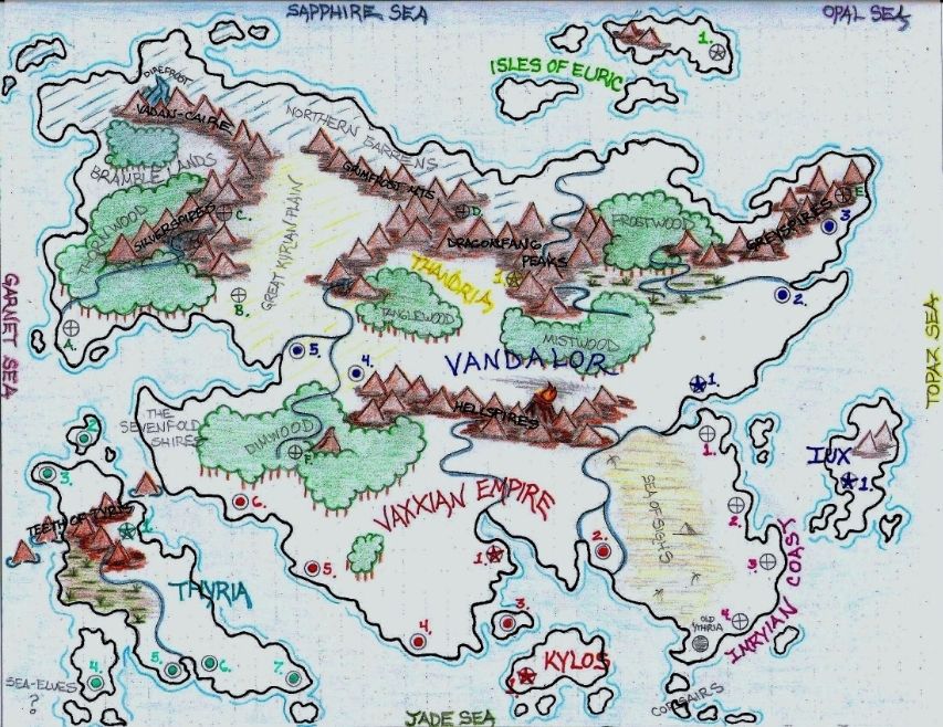
Continental Map 1/4"= roughly 2-3 days overland travel (adj. by terrain + circumstances), 1/4"= roughly 1-2 days travel by sea, 1 day by air (adj. by weather+ circumstances).  Starred circle=Capitol city, Colored circle= City, Crossed circle=Independant City-State. Teal=Thyria, Red=Vaxxian Emp., Orange=Kylos, Burgandy= Imryian Alliance, Purple=Iux, Blue=Vandalor, Yellow=Thandria, Green= Euric, Letters=Free City-States. *City-Key pending*  |
|
|
|
Post by XAVIOK on Mar 28, 2013 18:38:51 GMT -8
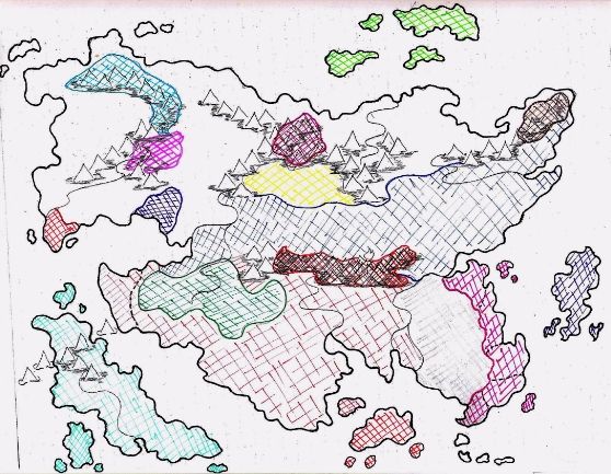
 Brown=Ironhollow & Anvilfrost (Greyspire Dwarves), Blue=Vandalor, Lt. green=Euric, Burgandy+Black=Grumblehiem & Sunderstone (Dragonfang Dwarves), Yellow=Thandria, Green=Vey'lamyr & the Sylvan Elves, Red=Vaxxian Emp., Orange=Kylos, Burgandy=Imryian Alliance, Purple=Iux, Teal=Thyria, Pink=Gnomes of Glittergate, Orange+Black=Thurgaxx & the Hellspire-Hordes, Purple (west)=Whitespire, Orange (west)= Free-City of Westreach, Lt.Blue= Valkan-Korr & the Giants of the Vadan-Caire * Kingdom of Kalendar* -Not Shown (yet) |
|
|
|
Post by XAVIOK on Mar 28, 2013 19:36:04 GMT -8
Yes, Kylos looks red on here, it's actually orange.  Oh well it was red for many years & Vaxxian powers still play a strong role in Kylosian politics. "Oredge". |
|